The Regionals
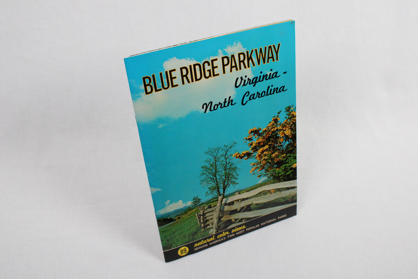
Blue Ridge Parkway / Virginia-North Carolina, by Aerial Photography Company
Blue Ridge Parkway / Virginia-North Carolina, by Aerial Photography Company
Couldn't load pickup availability
ATLANTIC SOUTH.
Guidebook.
This slender volume of about 20 pages is one of our great estate sale finds. In “like new” condition despite its age (which we put in the mid-late 1950s), here is a photographic journey down one spectacular drive: “Blue Ridge Parkway.” An engineering marvel when conceived in the midst of the Great Depression, the vision of a motorist tourism road down the spine of the Blue Ridge began in wake of the tremendous success of an earlier, if much shorter, road. The Skyline Drive runs down the Blue Ridge within Virginia’s Shenandoah National Park. Being an easy drive from the capital city, even in the 1930s, it became a favorite of President Franklin D. Roosevelt. At the president’s urging, $4,000,000 was approved to fund the “Appalachian Scenic Highway” (its first title) with the monumental idea of linking the two great Appalachian national parks of the east: the Shenandoah and the Great Smokies. The road would run down the Blue Ridge, before veering around Asheville, North Carolina, up onto the Black, Craggie, Pisgah, and Balsam ranges, which ultimately delivered motorists to the gates of the Great Smoky Mountains National Park. A public / private project like few in American history, an army of laborers had about half the road, including many monolith stone bridges (that are still one of the road's most enjoyable landmarks) completed prior to World War II resetting all national priorities towards the war effort. It would take a recommitment following the war to complete its 469 mile trace. And as this perfect little volume, and its “89 natural color views” illustrates, we are all beneficiaries to this day. A remarkable set of photographs are contained within this book. (Of note is the copyright given to the “Aerial Photography Company.”) By design, this was not only to be a road through the wilderness, but was meant to mingle the curated and natural, a mix of planned parks, agrarian lands, geology, history, the still evident imprint of native peoples (especially in large fire-cleared meadows), and wilderness. From the Peaks of Otter to Roaring Gap, Linville Falls to Grandfather Mountain (its caption: “Said to be the oldest mountain in the world”), and Looking Glass Rock, the highest point @ 6053 feet just east of the Smokies, the tunnels, the rhododendron, the “flaming azalea”’ (a wild orange azalea native to southern Appalachia), the vistas, the sunsets, etc. etc. etc., this here is one amazing volume. [Condition: As mentioned, this slender volume, 60-70 years old (our circa estimations based on the state of the photography and printing), is near perfect. Really all, there is hardly a nick on it.]
Condition: Like New.
Travel / Touring.
Aerial Photography Company.
Dexter Press, c. 1950s.
Softcover, 20+ pgs, 7 x 10" / 5 oz
1 in stock