The Regionals
Colorado Department of Highways “Colorful Colorado” 1955 Map / Brochure / Guide
Colorado Department of Highways “Colorful Colorado” 1955 Map / Brochure / Guide
Couldn't load pickup availability
MOUNTAIN WEST.
State Map / State Roadway Map / Topographic Map, Brochure / Guide, 1955.
(This fold-out map ships for free.)
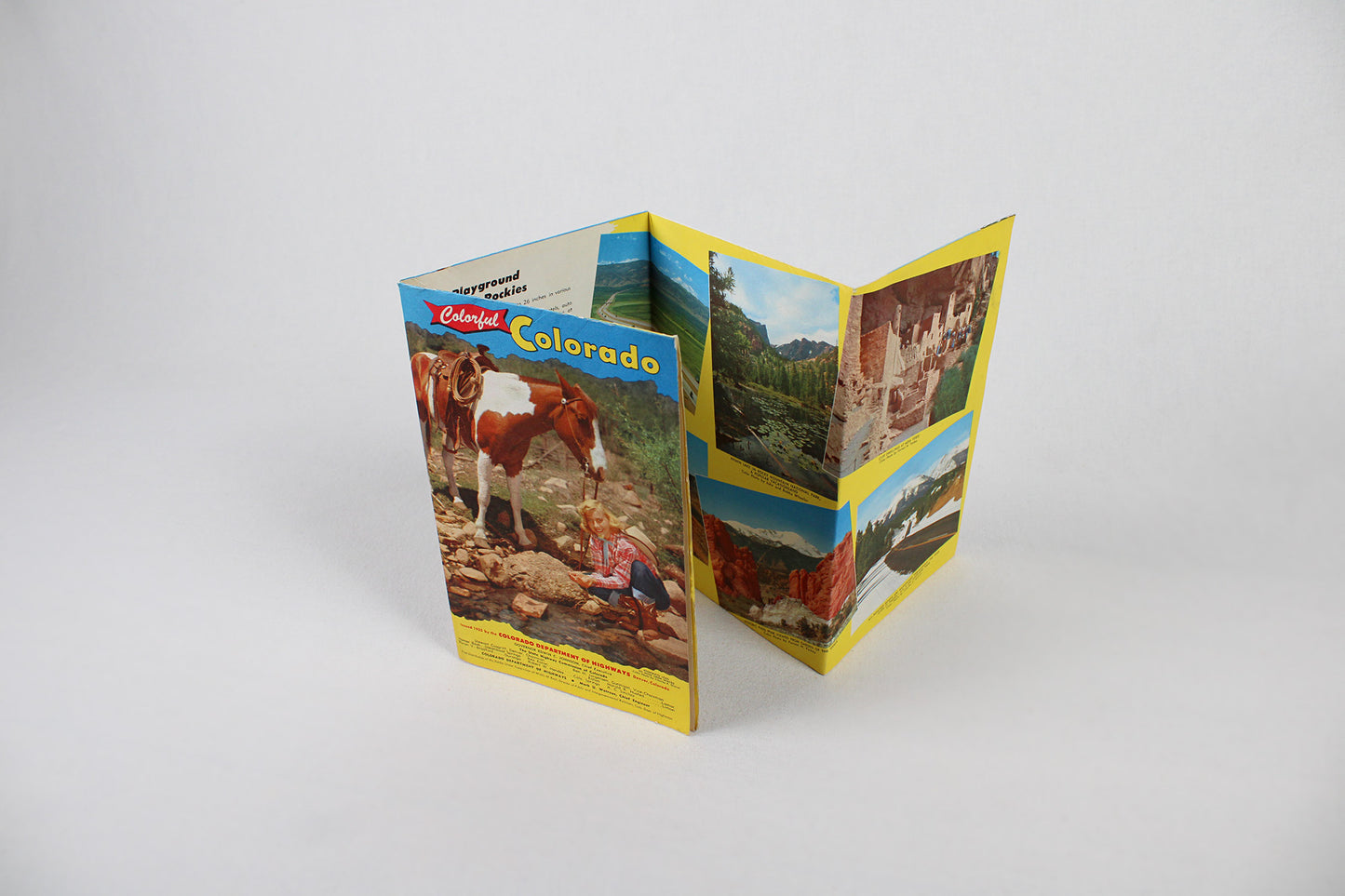
“Delightful! That’s what visitors say about the climate, the scenery, the great recreational areas in the mountains, the pure air and water, the sunshine and the friendliness of the people of Colorado.” This intro sets the tone for this fantastic mid-century car culture find. Printed on a thick paper stock and in full color, what may look like a simple 5x8” tourist brochure unfolds to include a detailed state atlas and mileage chart, a topographic map, and enough tourist boosterism to entice anyone who might have been considering a visit to Colorado to start up the family sedan and get packing. Put out the year before the Interstate Highway System came into being by way of a 1956 federal law, this map showcases the already thick network of state and U.S. “highways” that preceded it (much of which would soon be incorporated into the Interstate System). Mid-century Colorado’s intricate weave of major state freeways and U.S. routes are all the more impressive considering the ground over which much of it had to run. And as a reminder, one only has to unfold this piece fully to reveal a fantastic topographic map on its interior. Reminding motorists to “Do Your Share, Drive With Care,” there is a section packed full of details about the state’s remarkable “National Parks and Monuments” (including elevation lists of mountain peaks and passes), plus another dedicated to “National Forests, Scenic Areas, and Special Events”; the later listing everything from the “Arkansas River Boat Race” in Salina to La Juna’s “Early Settler’s Day”, “Potato Day” in Carbondale to the summer long concert series at Red Rocks Amphitheatre (the original construction a Civilian Conservation Corps project dating to 1941). With a fold-out listing helpful tips on where to eat and stay, summer and winter recreation, and repeated mention of Colorado’s wide-open spaces, this packed-full guide takes you from the cliff dwelling Mesa Verde to the then highest auto road in the world atop Mount Evans, the truly unique Garden of the Gods to the state’s then nascent winter skiing industry and Christmastime displays in the state capital of Denver. A mailable brochure / guide, there is only slight wear on its 70+ year old outer edges. The interior is pristine, a truly wonderful find.
Condition: Used Very Good.
Travel Related.
Dimensions: 5.5” wide x 8.5” (folded) / 22” wide x 34” high (unfolded)
1 in stock