The Regionals
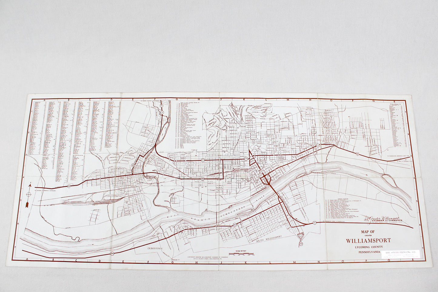
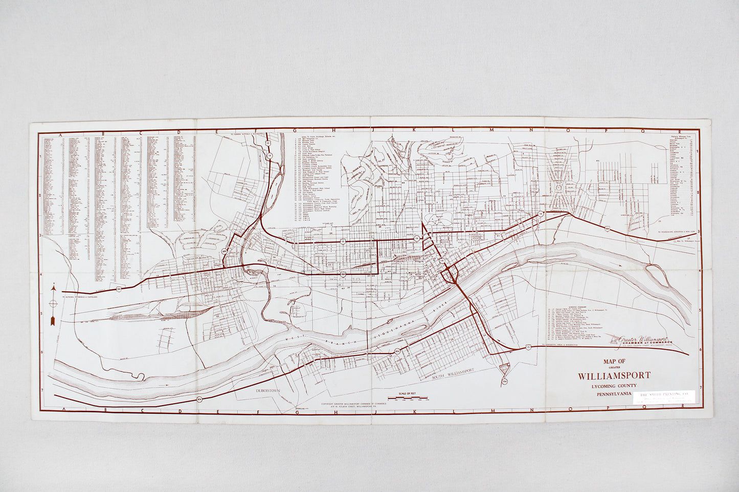
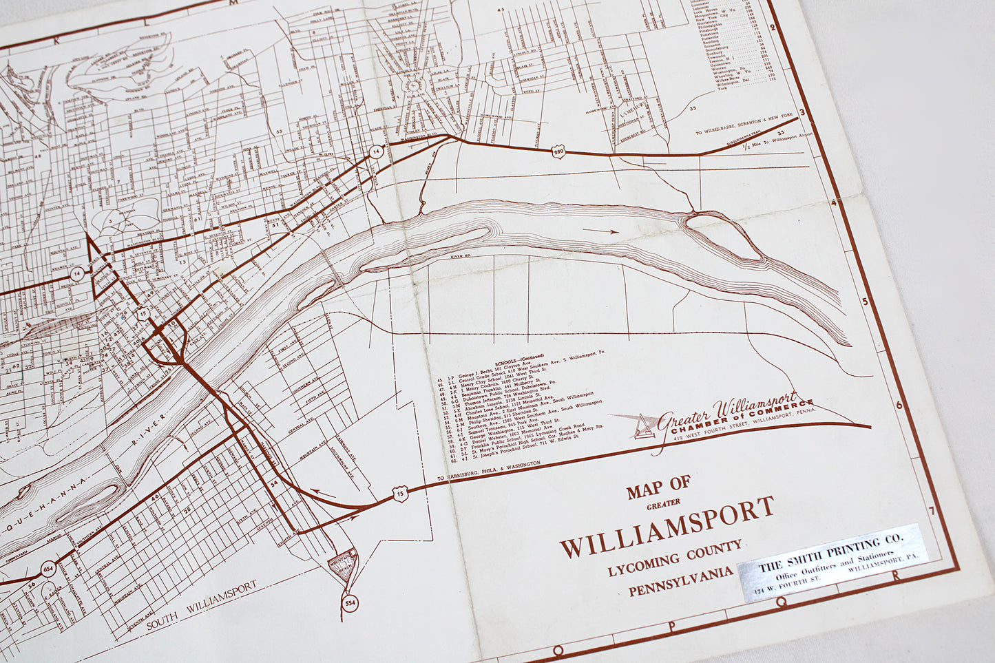
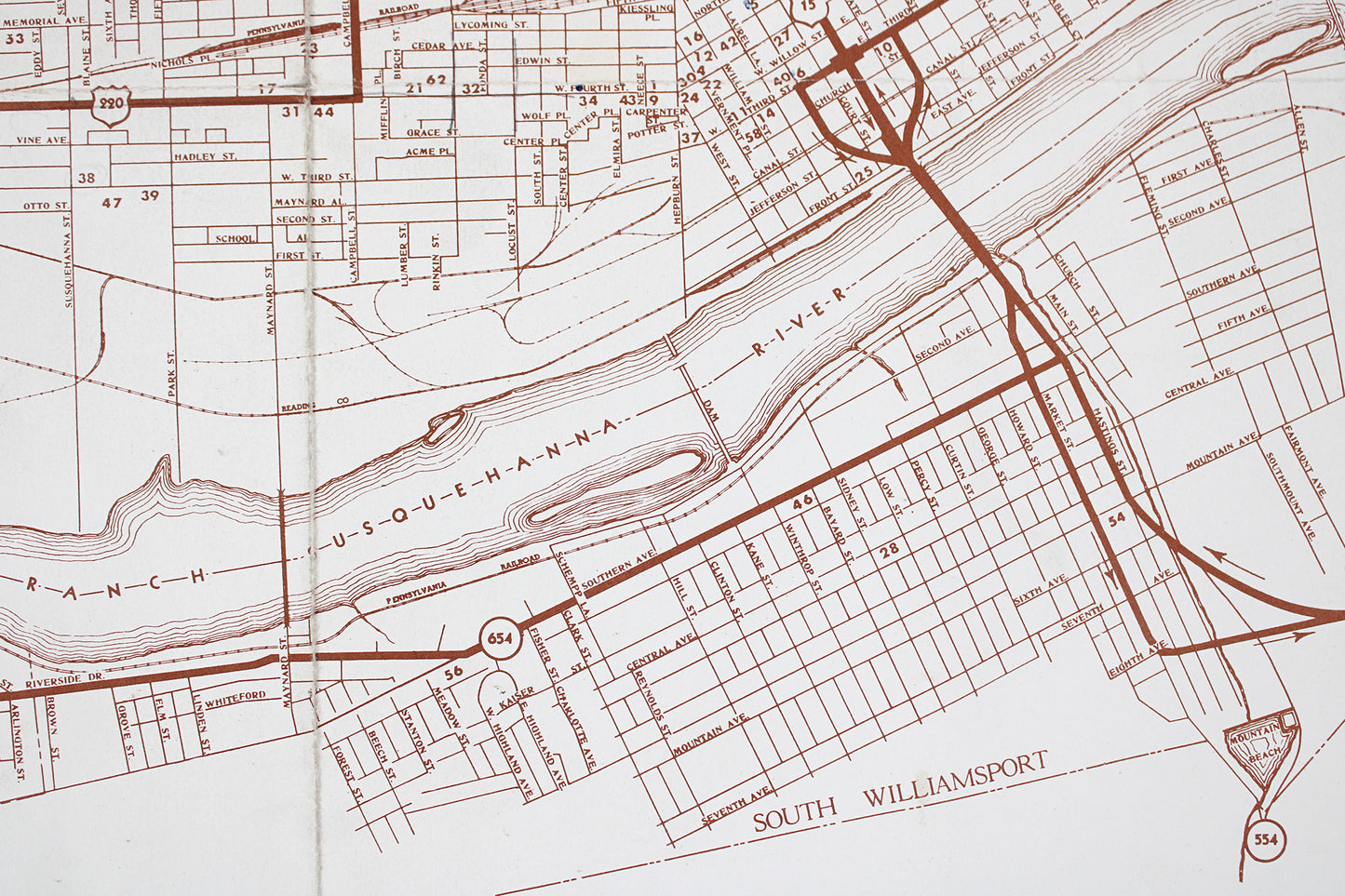
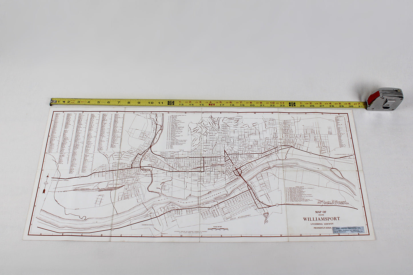
Map of Greater Williamsport, Pennsylvania, Lycoming County
Map of Greater Williamsport, Pennsylvania, Lycoming County
Couldn't load pickup availability
MID-ATLANTIC.
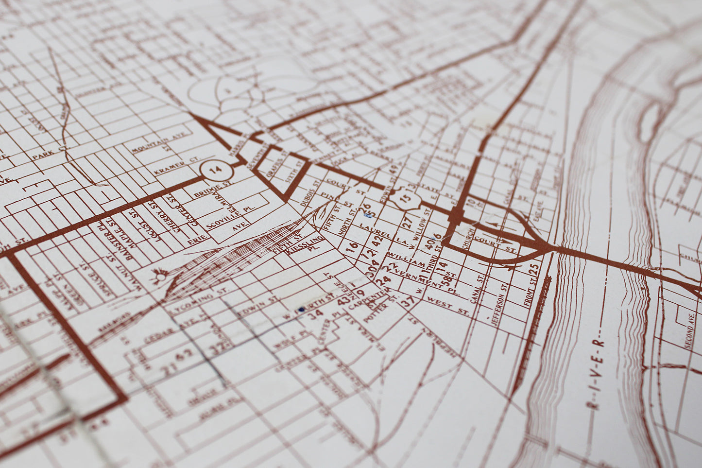
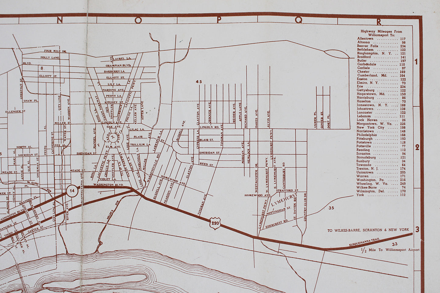
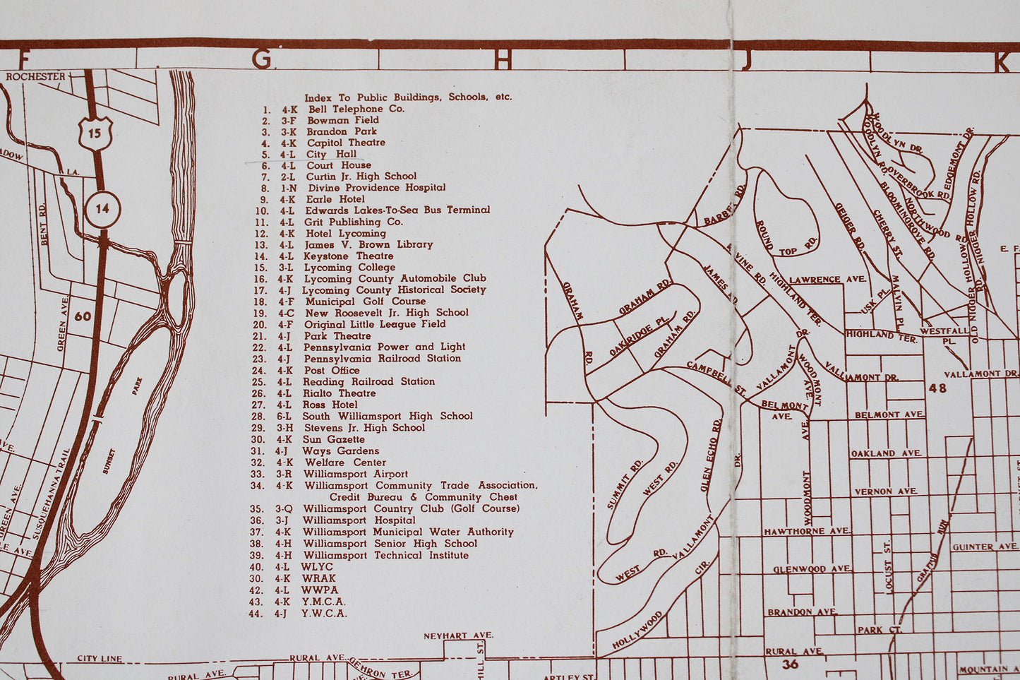
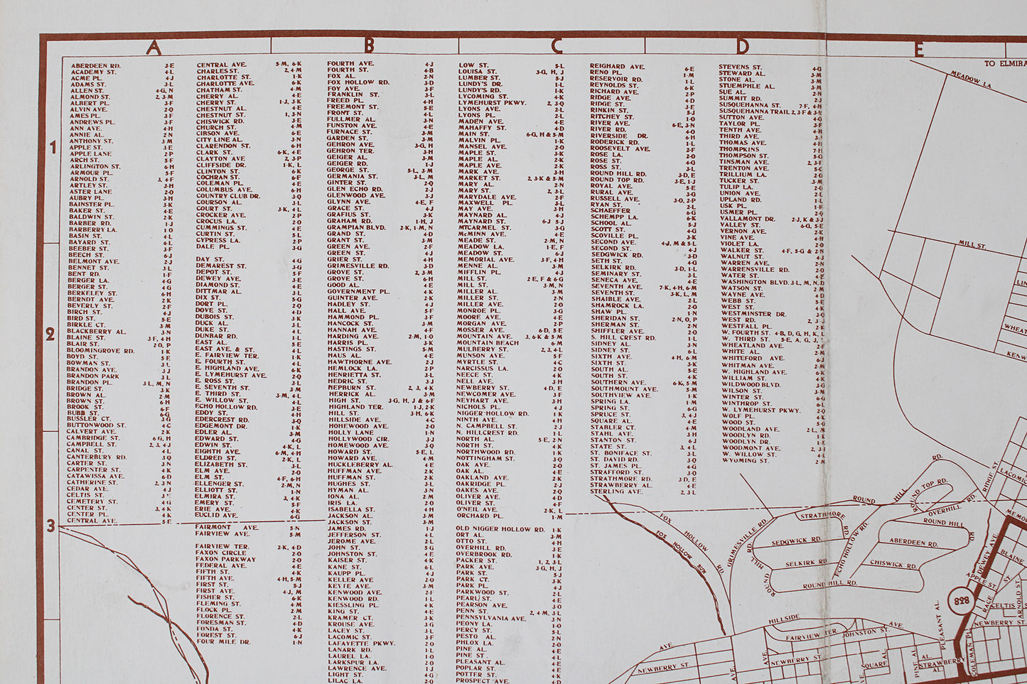
Street-Level Map, c. 1960s.
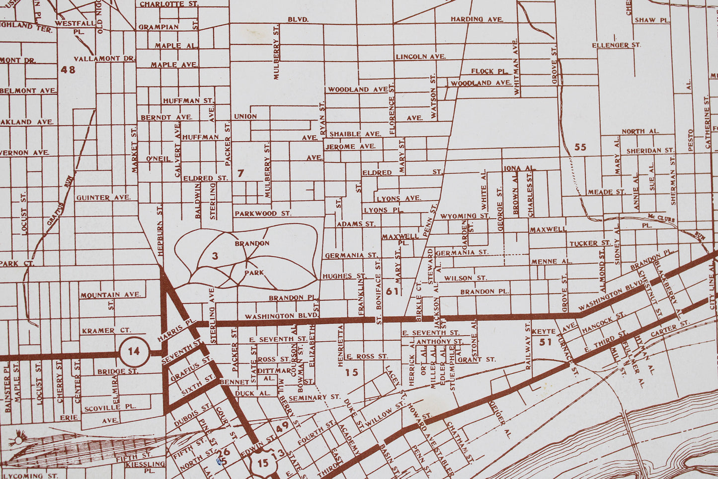
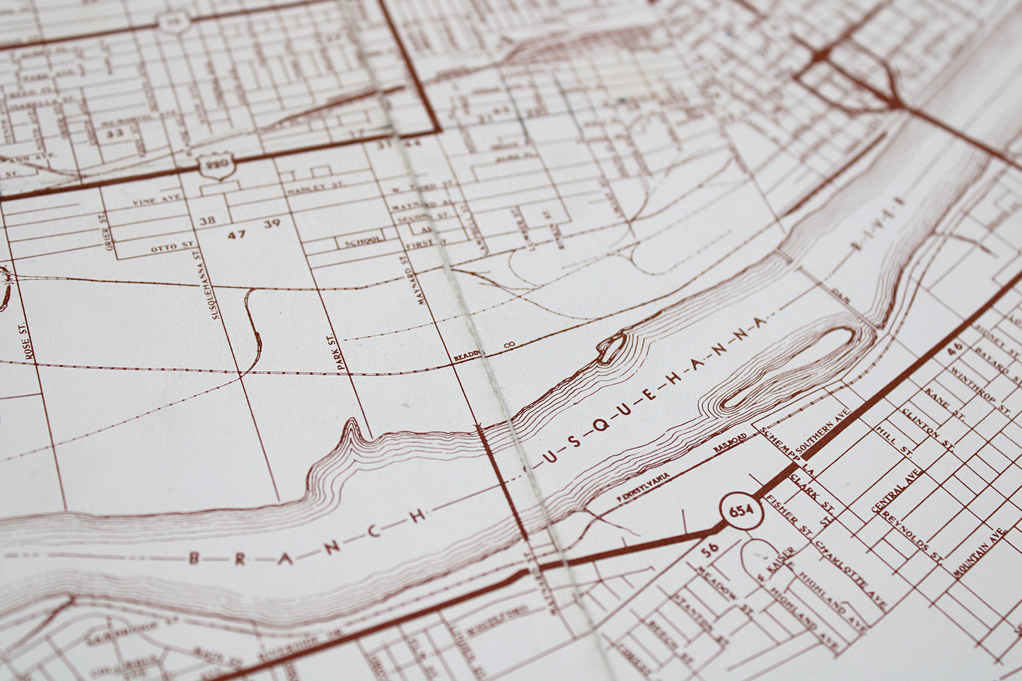
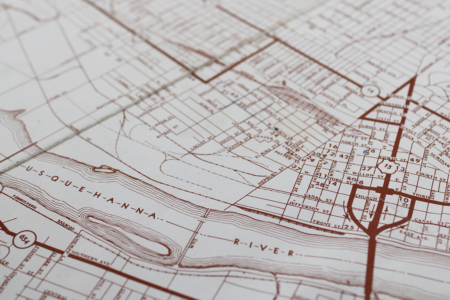
This well-crafted map of downtown Williamsport, Pennsylvania, is a fine example of our “local industry” line: found objects & items sponsored by or created by local chambers of commerce and businesses. Part local economic boosterism, part local industry advertisement, and in the case of city maps like this one, rendered with an obvious dose of civic pride, the character of these frame-able cartographic windows on the past resonates over half-a-century later. This map required extensive digging in order to get close to a circa date, which we put at mid-late 1960s. The first clue was Route 15 (commonly known as Market Street) still serving as one of the main points of entry into this small city located in the north-central x north-eastern region of the Keystone State. Not yet visible is the interstate spur I-180, which runs today in an arc from I-80 to loop in Williamsport, Jersey Shore, Lock Haven, and other smaller municipalities gathered along the branch of the Susquehanna River running to the north of that principal east-west interstate. Given that I-180 was not opened to traffic in Williamsport until 1983, with construction starting in the late 1960s, this provides our first clue. The second more obvious clue is a Pennsylvania Railroad yard still being located in the downtown area, which is today mostly parkland bordered by Little League Boulevard (this, though the event for which the town is most known today—The Little League World Series—is played in South Williamsport across the river; the original LLWS field having been west of downtown near Memorial Park). Though major rail traffic slowed across the post WWII era, railroad enthusiast blogs point to daily passenger lines having ceased operations in Williamsport and surrounding localities by the late 1960s. Given the general shift towards automobiles and the construction of roadway networks blooming across Pennsylvania and the United States during the middle of the 20th century, this all checks out. One final source stated that Penn Central abandoned the line in 1972, which would explain this area reverting to the city and its use today as green space … The fine detail and the local industry label is what initially hooked us and convinced us that it would get its “hooks” into others. In solid shape, there are just a few minor tears at the points of the original folds, as well as some wear around the folds, while a few landmark numbers were circled at some point (which we erased the best we could).
Condition: Used Very Good.
Local / Regional Industry.
Dimensions: 30" wide x 13" high
1 in stock