The Regionals
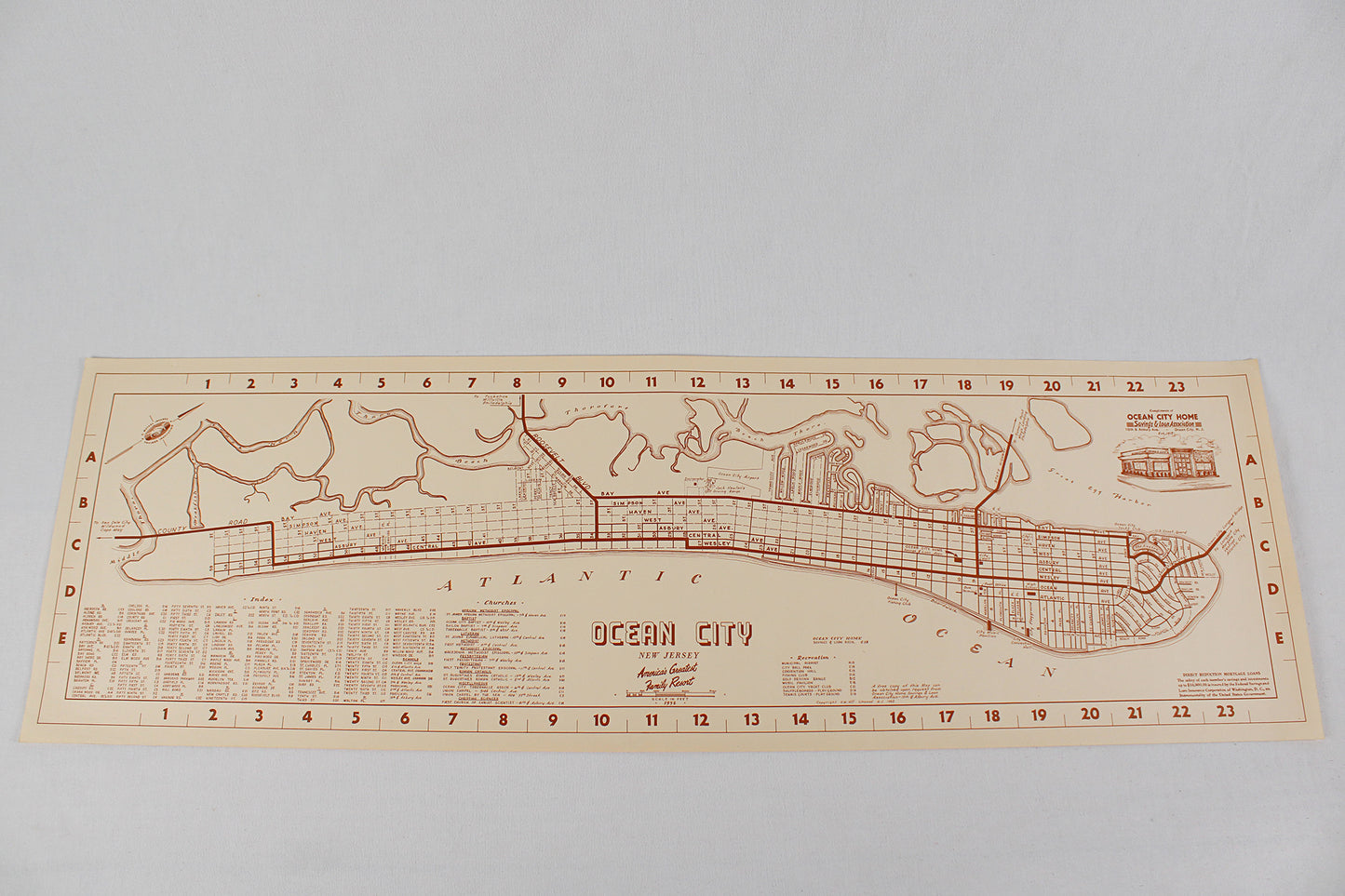
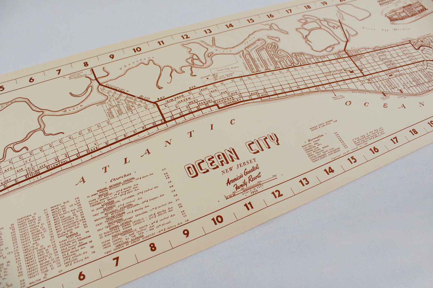
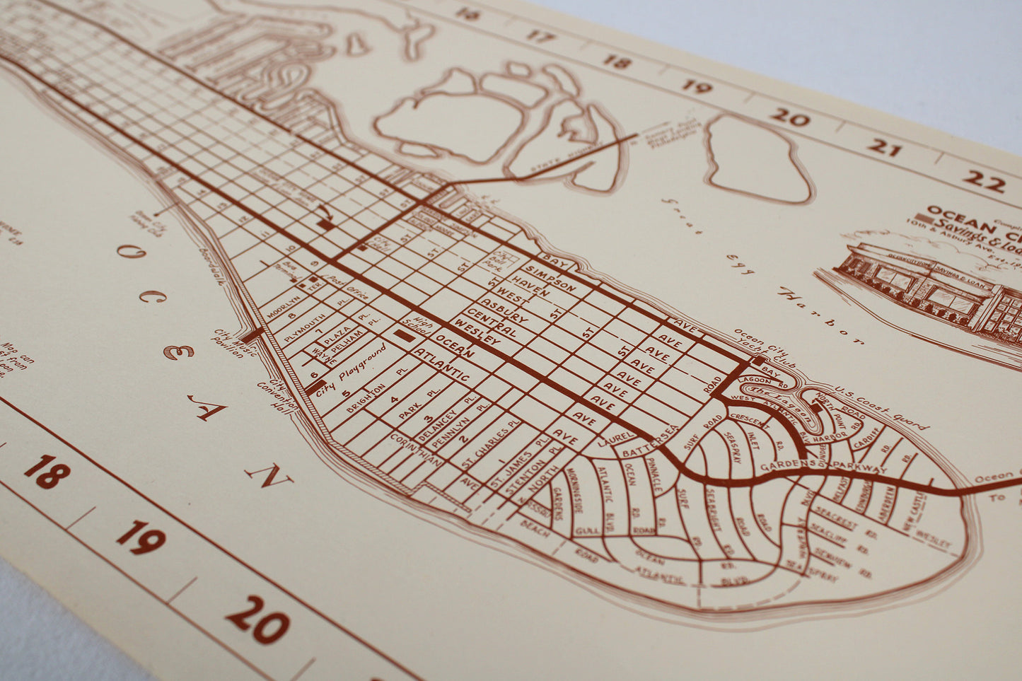
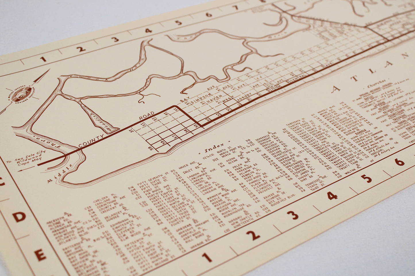
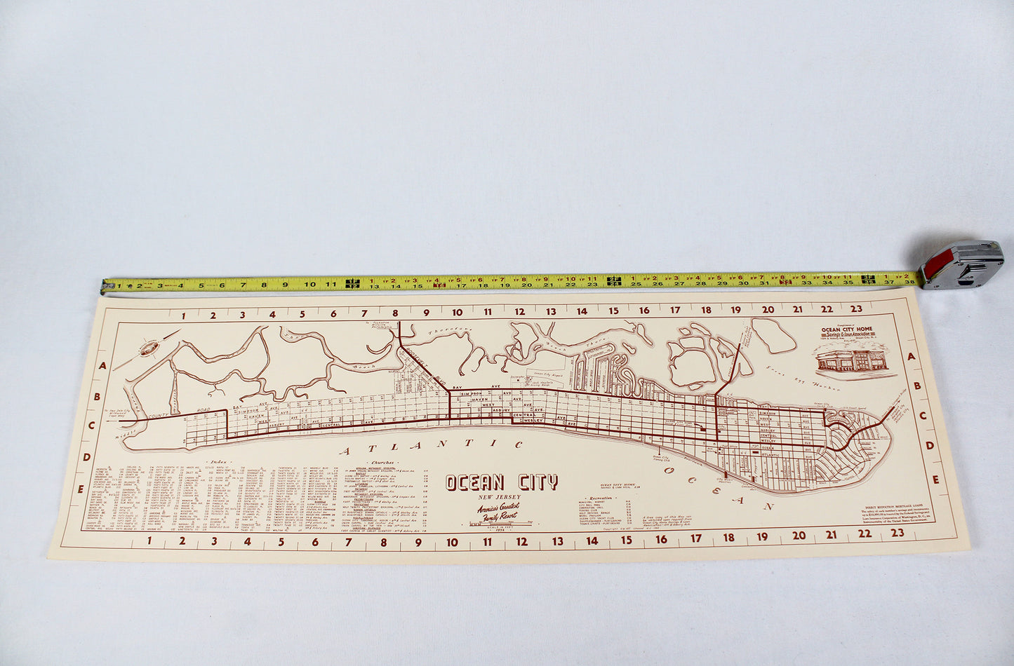
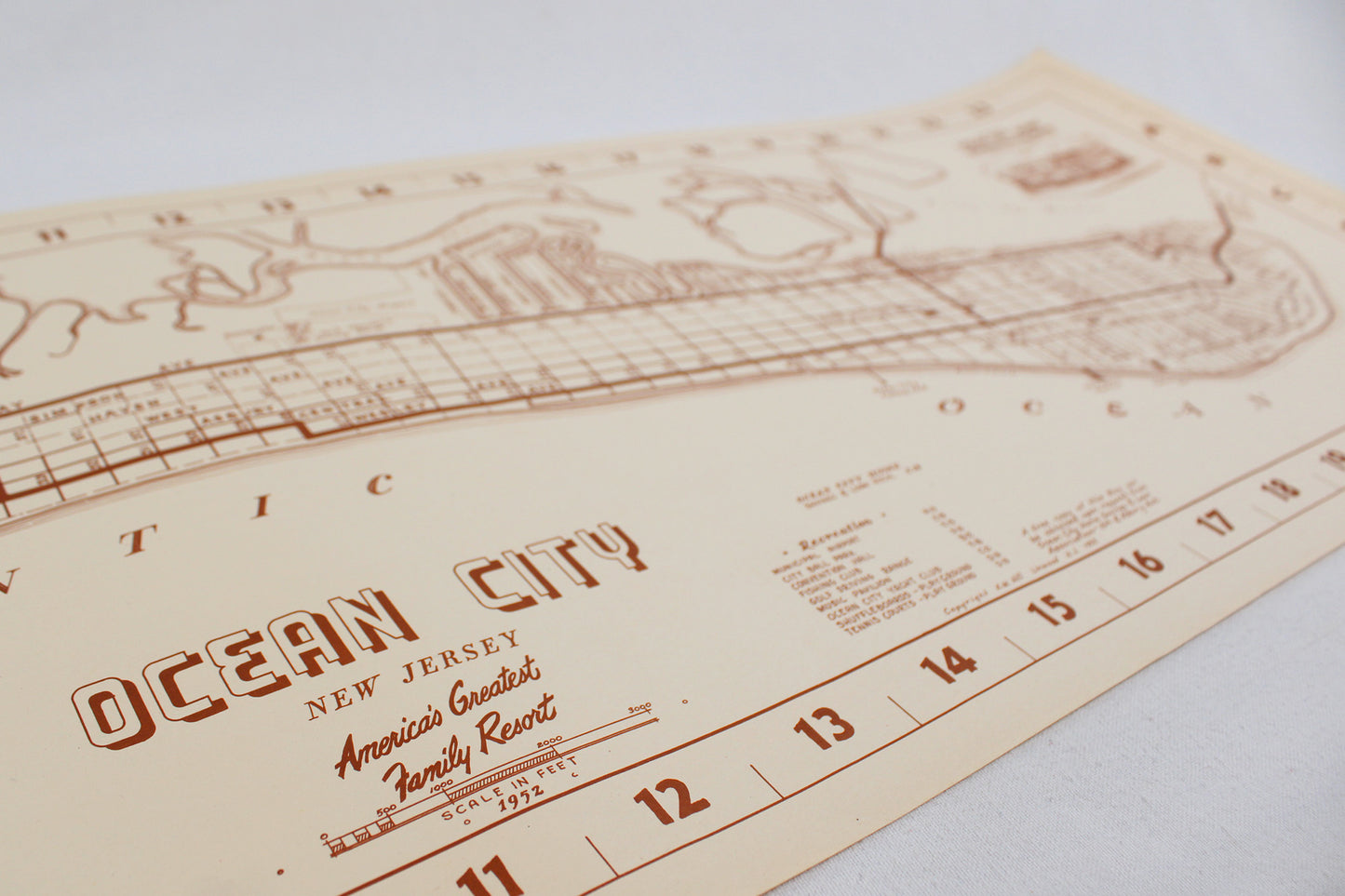
Ocean City, New Jersey, “America’s Favorite Family Resort” City Map, 1952
Ocean City, New Jersey, “America’s Favorite Family Resort” City Map, 1952
Couldn't load pickup availability
MID-ATLANTIC.
Street-Level Map, 1952.
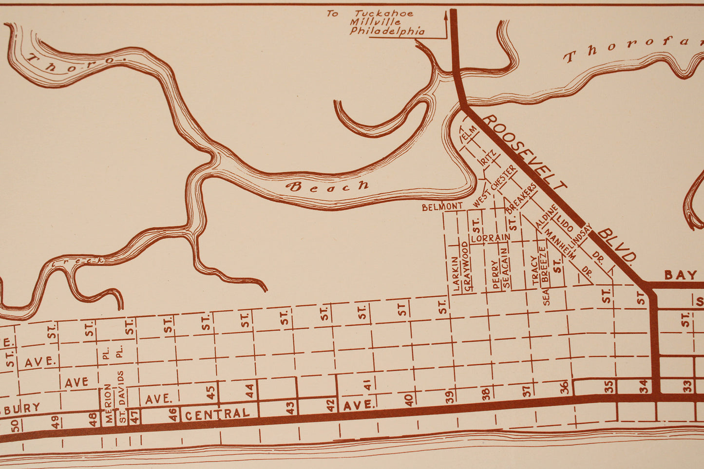
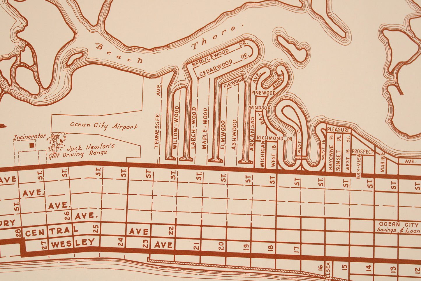
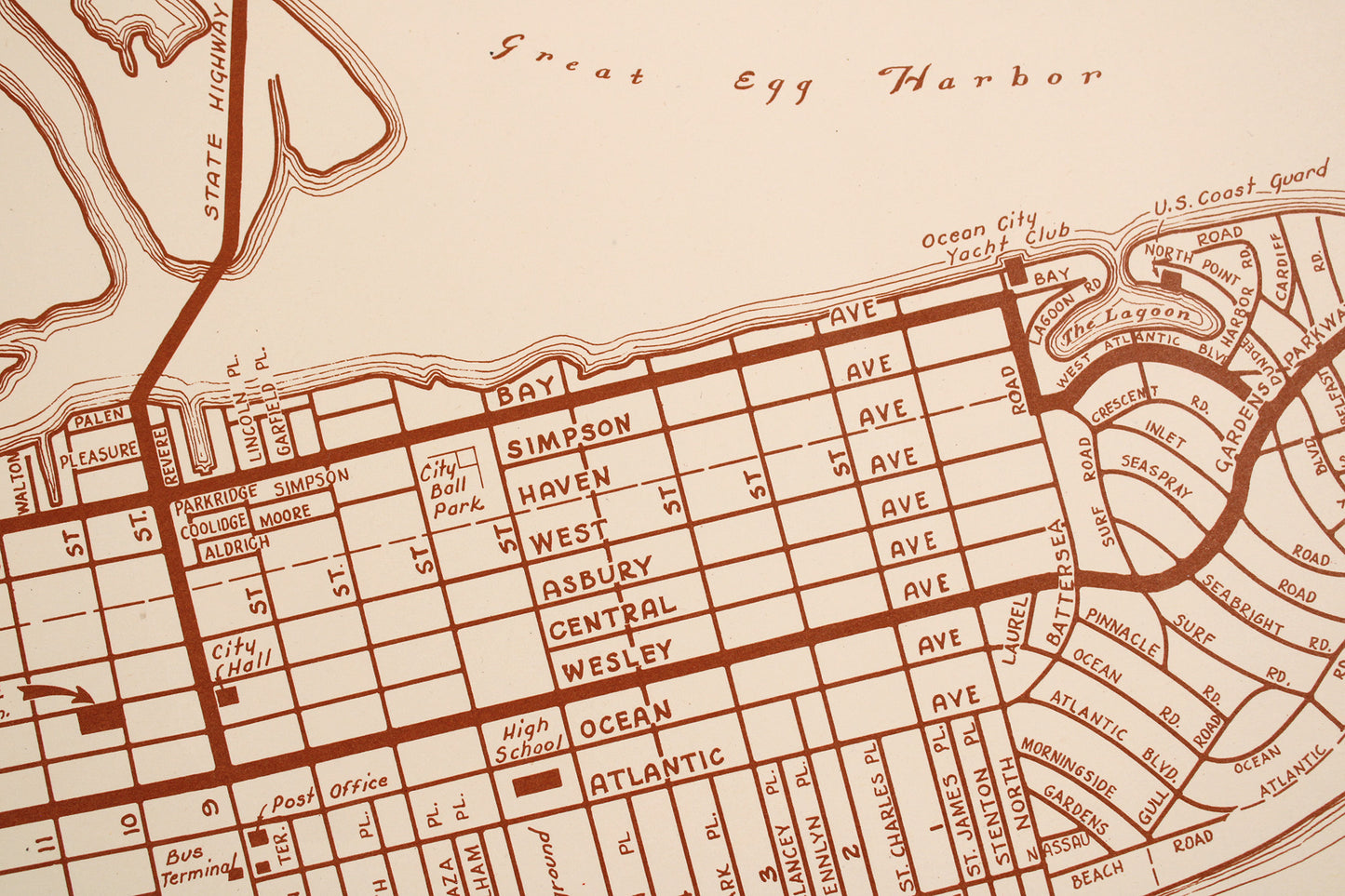
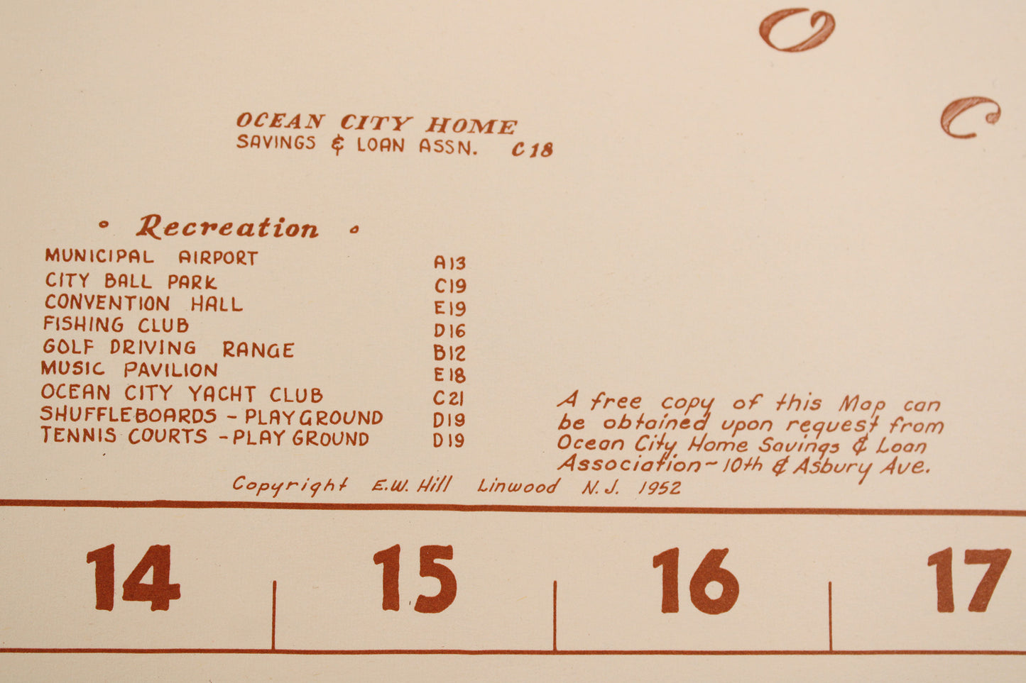
This heavy paper map was quite a find. It tells a clear story of growth and vitality, while hinting at a hidden one. Ocean City itself dates to the late 1800s and is at the northernmost tip of Cape May County in south coastal New Jersey. It truly is an “ocean” city bordered on its front by the Atlantic Ocean and the Great Egg Bay at its back west-facing side. This is a near pristine example of maps that were sponsored by local industry in the post WWII era: a finely detailed map of the “product” (house plots), as well as an ad for the company, in this case: Ocean City Home Savings & Loan. Eager to extend “Direct Reduction Mortgage Loans,” the comprehensive real-estate grid and street-level map also includes a list of churches and, tying into the map and city’s pitch: city recreation spots. Of course, the hidden story concerns the local associations and chambers who were often a motivating force in the makeup of such maps (if not directly involved in the buying and selling of properties). They would perform the ignoble social “policing” of desirable neighborhoods, limiting them to mainly white families only. Endemic to American municipalities large and small during the mid-late 20th century, African-American and other “ethnic” families seeking home ownership were often constricted to less-desirable, often financially challenged, areas. Done without a paper trail via in-person “screening” (thereby avoiding legal challenges in an era of robust civil rights movement in the courts), “redlining” was a wealth-stifling practice that went on for far too long … Still, that unfortunate chapter in recent American history does not take away from the craft invested in this wonderful map. It was quite the find (for which we probably paid too much!) and in paper form showcases the vibrancy and confidence of post-war America’s real estate boom. It is also fascinating to overlay 75+ years of “Ocean City’s” beachfront development over this map, with erosion, dredging, and the continual natural and manmade remaking of its beaches a constant to this day.
Condition: Used Very Good.
Local / Regional Areas.
Dimensions: 38" wide x 12" high
1 in stock